Resilio Studio

Design for Resilience

  • About
    • Who we are
    • Philosophy + Practice
  • Projects
    • Landscape + Urbanism
    • Social Innovation
    • Placemaking + Tactical Urbanism
    • Education
  • Media
  • Contact
  • About
  • Who we are
  • Philosophy + Practice
  • Contact
  • All Projects
  • Landscape + Urbanism
  • Social Innovation
  • Placemaking + Tactical Urbanism
  • Education
  • All Projects
  • Landscape + Urbanism
  • Te Whakaoranga o te Puhinui: Puhinui Regeneration
  • Te Kōpua – C40 Design Competition
  • Safe School Streets
  • Huapai Hub
  • Smiths Avenue
  • Onehunga Police Station Laneway
  • Taniwha Reserve
  • Rosedale Landfill Site Feasibility Study
  • Local Path Design Guide
  • Hamilton West Town Belt
  • Atlas Concrete Site Feasibility Study
  • Te Tohu o Te Auaunga
  • Greenway Network Plans
  • Omaru Creek Bridge
  • Rodney Greenways Feasibility Studies
  • The Tāmaki Path
  • Keri Downs Park + Carisbrook Reserve
  • Rawiri Stream Restoration
  • Kulim Park Redevelopment
  • Meola Reef Reserve Te Tokaroa Development Plan
  • Puketāpapa Permablitz Project
  • Awa Road Eco Retreat
  • Unitec Tactical Urbanism Studio
  • Visualising Active Transport
  • Tactical Urbanism Opportunities for Auckland City Centre
  • Productive Gardens and Properties
  • Social Innovation
  • Te Whakaoranga o te Puhinui: Puhinui Regeneration
  • Te Kōpua – C40 Design Competition
  • Safe School Streets
  • Huapai Hub
  • Waitematā Community Composting
  • Smiths Avenue
  • Pt. Chevalier Placemaking
  • Local Path Design Guide
  • Auckland Permaculture Workshop
  • Waiheke Collective External Facilitation
  • Healthy Families Lab
  • AUT Design Studios
  • Puketāpapa Permablitz Project
  • Auckland Kai Lab
  • Unitec Tactical Urbanism Studio
  • Tactical Urbanism Opportunities for Auckland City Centre
  • Placemaking + Tactical Urbanism
  • Safe School Streets
  • Pt. Chevalier Placemaking
  • Unitec Tactical Urbanism Studio
  • Tactical Urbanism Opportunities for Auckland City Centre
  • Education
  • Te Kōpua – C40 Design Competition
  • AUT Exceptional Learning Experiences
  • Auckland Permaculture Workshop
  • Healthy Families Lab
  • The Design Process: A Primer
  • AUT Design Studios
  • Unitec Tactical Urbanism Studio

The Tāmaki Path

previous arrowprevious arrow
Tamaki-Path-5_Rev-2-1920W
Tamaki-Path-1_Rev-3-1920W
Tamaki-Path-6_Rev-3-1920W
Tamaki-Path-2_Rev-3-1920W
Tamaki-Path-3_Rev-2-1920W
next arrownext arrow
Tamaki-Path-5_Rev-2-1920W - copy
Tamaki-Path-1_Rev-3-1920W - copy
Tamaki-Path-6_Rev-3-1920W - copy
Tamaki-Path-3_Rev-2-1920W - copy
Tamaki-Path-2_Rev-3-1920W
previous arrowprevious arrow
next arrownext arrow
Date
2016 - 2017
Client
Auckland Council
Collaborators
GHD  •   Morphum Environmental  •   Ngāti Paoa  •   Ngāi Tai ki Tāmaki

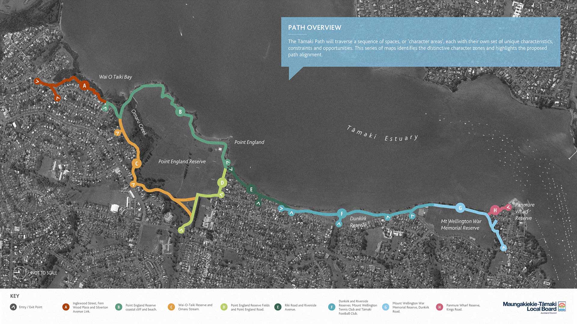
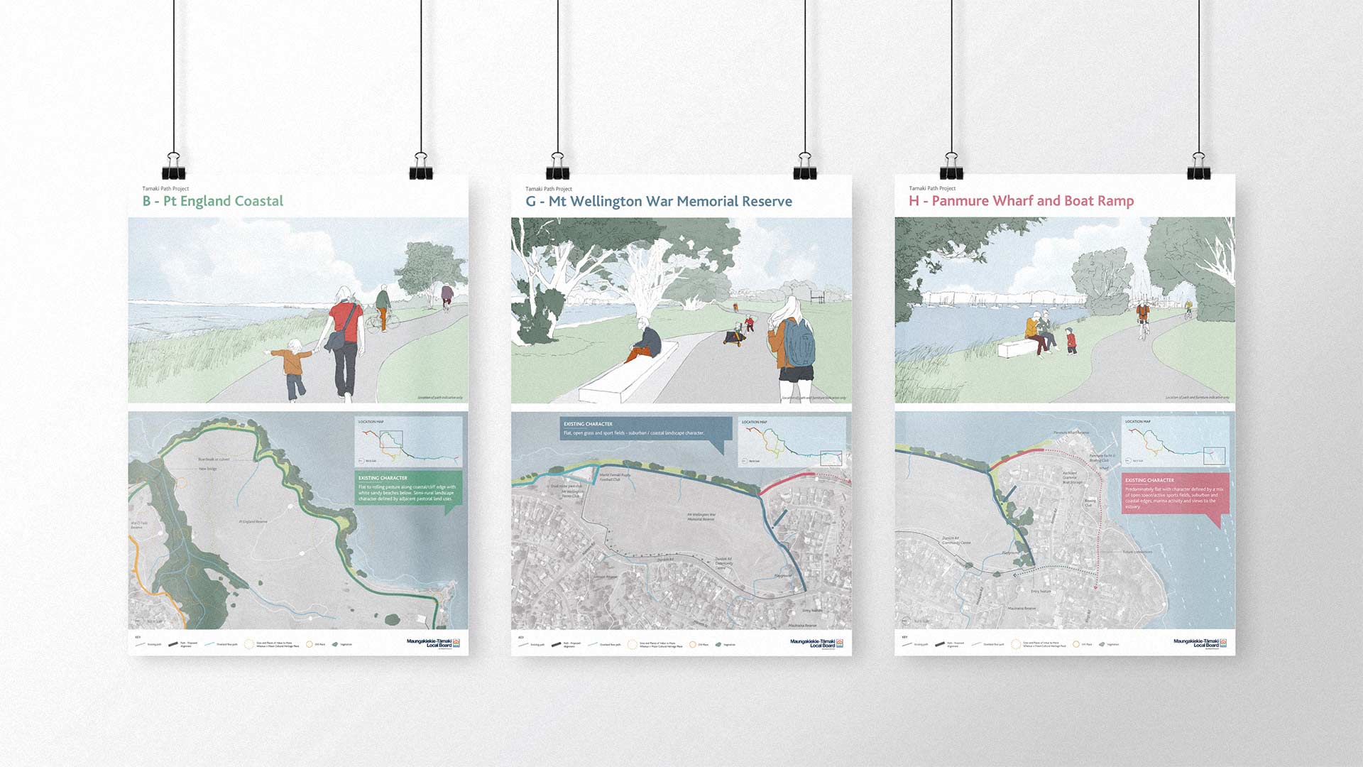
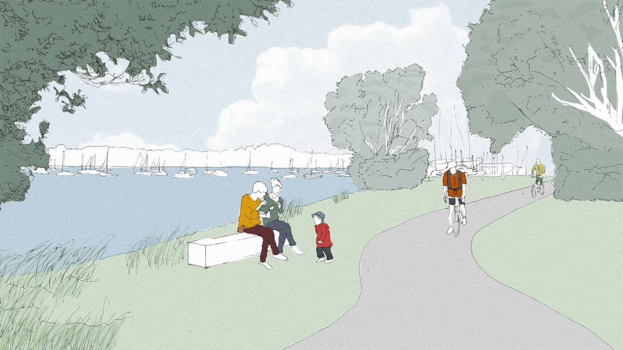
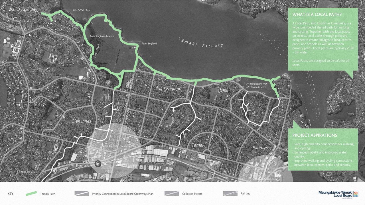
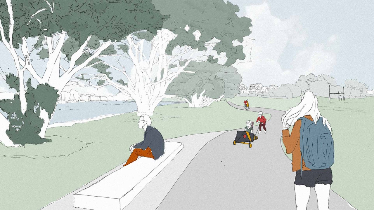
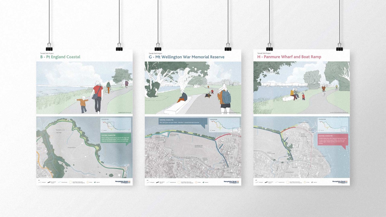
Resilio Studio are working with GHD and Morphum Environmental to plan and design a 10 kilometre shared path along the western edge of the Tāmaki Estuary. The path is a significant opportunity to contribute towards developing Auckland’s walking and cycling infrastructure, as well as providing a priority connection in the Maungakiekie-Tāmaki Local Board’s adopted greenways plan. The Tāmaki Path, which runs from Wai‐O‐Taiki Reserve in Glen Innes to Panmure Wharf Reserve, will traverse a wide range of character areas including coastal edge reserves, native bush, open fields, grazed paddock and recreational areas. Resilio have been leading the overall landscape strategy and design for the path, which proposes eight distinct character zones along the length of the path, each with their own set of unique characteristics, constraints and opportunities.

Resilio logo