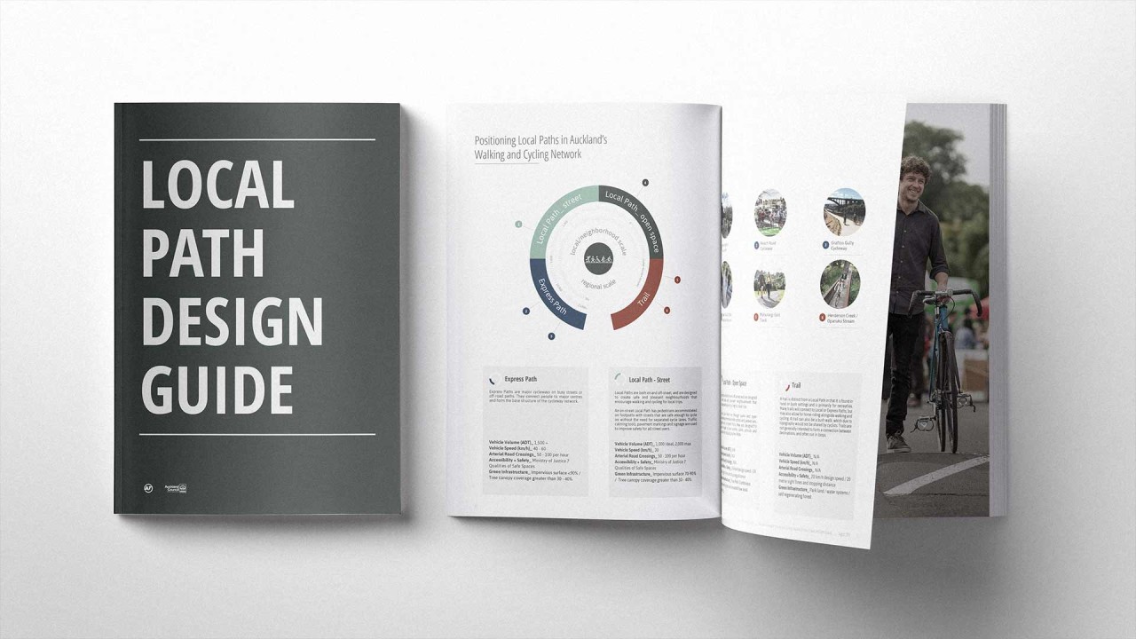
Local Path Design Guide


Date
2015 - 2016
Clients
Walking and Cycling Team, Auckland Transport • Parks and Open Space Team, Auckland Council
Collaborator
MRCagney
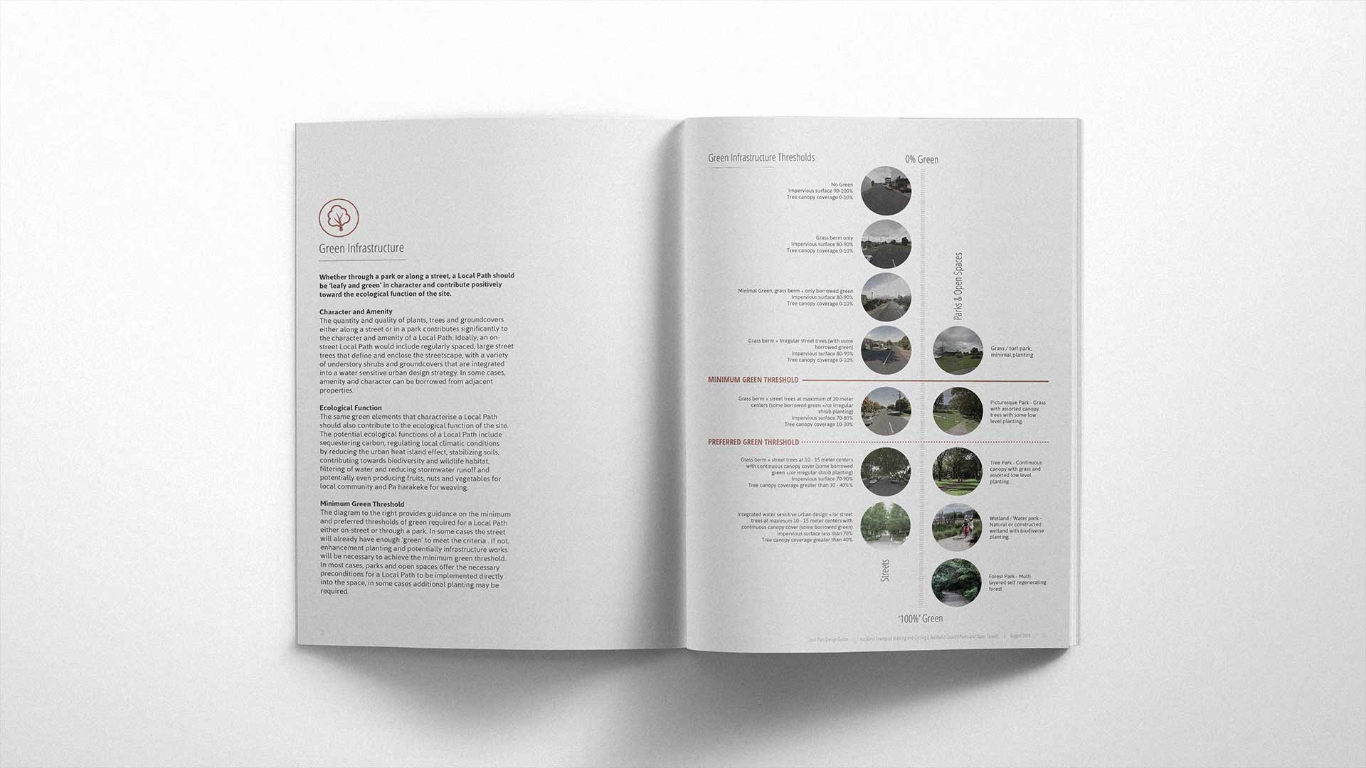
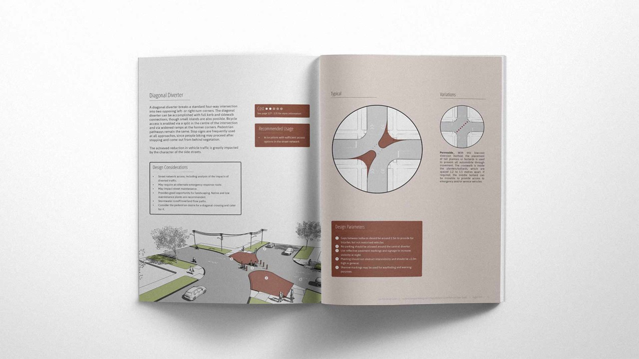
The Local Path Design Guide (previously known as the Greenways Design Guide) was developed to provide best practice guidance for designing and developing successful local path networks through our neighborhoods and across the Auckland region. This project furthers work underway in Auckland to re-imagine and reclaim our streets. The guide sets out to initially define Local Paths as quiet streets with slow-moving vehicles and routes through parks which extend the usefulness of the core cycle network as well as connect local destinations such as schools, town centres, and parks. The guide enables users to design Local Paths which are safe, enhance ecological function, think creatively about how to engage community and provide options and encourage transportation behaviour change for everyone. The Local Path Design Guide has been recognised with awards from the New Zealand Institute of Landscape Architects and The Association of Consultants and Engineers New Zealand. See our Media page for more details.